GRID3 Training Approach
We offer tailored technical assistance and training programmes based around the use and application of GRID3 and related spatial data. We aim to strengthen individual and institutional capacities in many sectors such as census survey planning and implementation, or planning for health and educational service provision.
Our Training Methods and Objectives
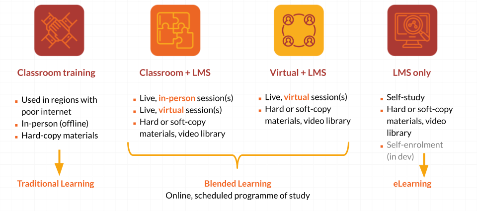
This Learning Management System (LMS) is the primary mechanism for delivering GRID3 training. Our training spans a range of topics in geospatial data and technologies, and reflects our core themes - human settlement, demographics and characteristics, health, education and infrastructure. The focus of GRID3 Training is practical tools and methods enabling people to explore these subjects in detail.
Geographic Information Systems (GIS) are covered extensively (both their practical use and application). The open source statistical application 'R' also features, in the context of population modelling (estimation). Finally, reflecting
our close asociation with national census apparatus, you can find training on household survey planning and implementation.
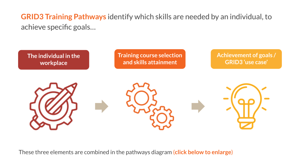
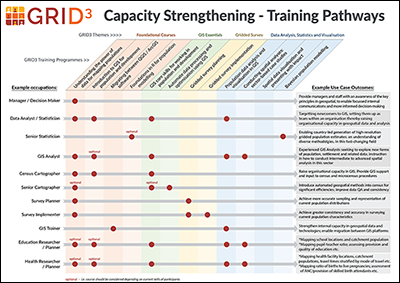
GRID3 Training Pathways
In order to provide the most relevant and appropriate training to groups and individuals we devised the Training Pathways guide. This addresses the key questions posed by learners "Which training courses are most suitable for my occupation, and what can they help me to achieve?"
How is GRID3 Training Delivered?
GRID3 Capacity Strengthening Solutions
- Make crucial geo-referenced data available and useful for decision makers.
- Strengthening countries’ capacity to produce and use those data by providing training and technical assistance
- Develop country-specific partnerships that bring government, science, and civil society together.