Available courses

Full title: Introduction to GIS for Population and Development Studies, using QGIS

An open online training programme from GRID3 – a learning pathway to using geospatial data and technologies for sustainable development.
Enrollment on this programme is now OPEN. Click here to enroll

  • Cost: free!
  • Time commitment:  approximately 20 hours
  • Format:  self-paced learning, with community support**
  • Certificates awarded upon completion of all programmed courses
  • Click here for programme information

**Access our discussion forums! Share your knowledge and learn from your peers.

Introduction aux SIG pour les études de population et de développement, à l'aide de QGIS

Un programme de formation en ligne ouvert de GRID3. Il s'agit d'une voie d'apprentissage pour utiliser les données et les technologies géospatiales pour le développement durable.
L'inscription à ce programme est maintenant OUVERTE. Cliquez ici pour vous inscrire

  • Coût : Gratuit!
  • Engagement de temps : environ 20 heures
  • Format : Apprentissage à son propre rythme, avec le soutien de la communauté*
  • Certificats délivrés à la fin de tous les cours programmés
  • Cliquez ici pour les informations sur le programme

*Rejoignez nos forums de discussion ! Partagez vos connaissances et apprenez de vos pairs.

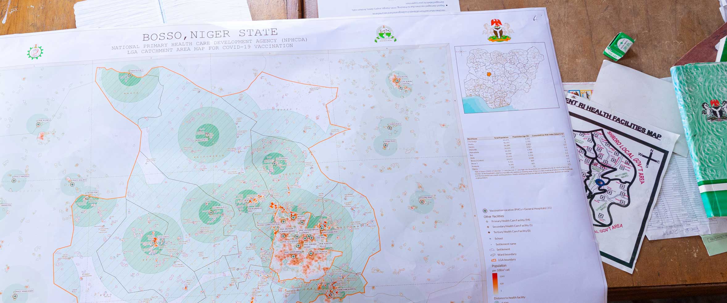
An open online training programme from GRID3. This is a learning pathway to using geospatial data and technologies to enhance microplanning procedures, reaching more people in need of immunisation and related services.

  • Cost: Free!
  • Enrolment from: June 2023 (date to be confirmed)
  • Time commitment : 4 – 8 hours, over 3 weeks
  • Certificates awarded upon completion of all programmed courses

Self-enrolment on this programme will be available. For a detailed programme outline, Click Here.

This course takes a broad look at the geospatial sector. Using accessible and non-technical language it addresses the question "What is a GIS, and what can this technology do for me?"

Who is it for?
It provides an important foundation to those who intend to progress to the practical GIS courses. However, it is also suitable as a stand-alone course for anyone looking at the big picture, wanting to know the potential gains and risks of developing geospatial capabilities.

Pre-requisites : None, other than a keen interest in Geospatial
Estimated learning time : 45 minutes
For more information: full course description PDF

In this section the aim is to break out of GIS theory and focus on how the technology is applied; specifically, how it makes a positive impact in people's lives. This page is an expanding library of case studies for your reference. It doesn't contain practical exercises. Check back regularly for new stories and relevant links from the Data for Development community.

Who is it for?
Anyone with an interest in the sector. It is particularly relevant for those working in government administration or NGOs, especially in health, education, population (census) or regional/national infrastructure.

Pre-requisites : None

This course will introduce the QGIS user interface, getting you familiar with the main tools and functions, to get you going quickly with GIS!

Who is it for?
Newcomers to GIS or those who want to get familiar with QGIS software. It is relevant for those working in government administration or NGOs, especially in health, education, population (census) or regional/national infrastructure.

Pre-requisites : General IT skills and familiar with Excel/spreadsheets
Estimated learning time : 2 hours
For more information: full course description PDF

This course is about getting to grips with GIS Data! It encourages good practice in where to find it, how and where to store it, and documenting your work!

Who is it for?
Newcomers to GIS or those who want to develop good habits in data management, acknowledging that doing so is a critical step towards working effectively in GIS.

Pre-requisites : General IT skills
Estimated learning time
: 1.5 hours
More information: full course description PDF

This course is about understanding coordinate reference systems, including map projections, which are used in different countries and regions of the world. Understanding CRS is crucial for accurate positioning of spatial data.

Who is it for?
Newcomers to GIS or those who need to understand issues around coordinate systems, issues which can cause errors for the GIS user.

Pre-requisites : Basic understanding of QGIS user interface
Estimated learning time : 2 hours
More information: full course description PDF

What is R ? How does it work and how does it store data?


Who is it for : Beginners or newcomers to R. This course is part of the first steps to population modelling.
Pre-requisites : Proficiency with basic statistics and familiarity with spatial data themes and practice.
Estimated learning time : 3.5 hours
More information: A008_1-What-is-R_Description.pdf

**Please note: course currently unavailable - check back soon!**

Manipulating and Managing data


Who is it for : Beginners or newcomers to R. This course is part of the first steps to population modelling.
Pre-requisites : Proficiency with basic statistics and familiarity with spatial data themes and practice.
Estimated learning time : 3.5 hours
More information: A008_2-Manipulating-and-Managing-Data-R_Description.pdf

**Please note: course currently unavailable - check back soon!**

Plotting Data and Working with Loops and Functions


Who is it for : Beginners or newcomers to R. This course is part of the first steps to population modelling.
Pre-requisites : Proficiency with basic statistics and familiarity with spatial data themes and practice.
Estimated learning time : 3.5 hours
More information: A008_3- Plotting-Data-and-Working-with-Loops-and-Functions-R_Description.pdf

**Please note: course currently unavailable - check back soon!**

Working with Raster Data and Dataframes


Who is it for : Beginners or newcomers to R. This course is part of the first steps to population modelling.

Pre-requisites : Proficiency with basic statistics and familiarity with spatial data themes and practice.
Estimated learning time : 3.5 hours
More information: A008_4-Working-with-Raster-Data-and-Dataframes-R_Description.pdf

**Please note: course currently unavailable - check back soon!**

A lot of the data that you will work with in GIS either starts, or can be transformed into table-based data. So it is important to get familiar with the various tools and windows within QGIS for working with this data type. This course will provide that.

Who is it for?
Although Skills taught in this course are applicable to GIS users in most sectors, it is especially relevant for those working in government administration or NGOs, in health, education, population (census) or regional/national infrastructure.

Pre-requisites : Foundation skills in QGIS (see Courses A001 to A005)
Estimated learning time : 2 hours
For more information: full course description PDF

Selections and queries are a set of techniques for sorting through a dataset, in order to isolate the records or features that you want to study. These are essential skills for a GIS user.

Who is it for?
Although Skills taught in this course are applicable to GIS users in most sectors, it is especially relevant for those working in government administration or NGOs, in health, education, population (census) or regional/national infrastructure.

Pre-requisites : Foundation skills in QGIS (see Courses A001 to A005)
Estimated learning time : 2 hours
More information: full course description PDF

Start creating features on your digital map! Study areas, catchment zones, travel routes, watercourses, locations of health posts or schools, or farms… Literally any geographic feature or phenomena! Get familiar with many different editing tools and techniques.

Who is it for?
Applicable to GIS users in most sectors, it is especially relevant for those working in government administration or NGOs, in health, education, population (census) or regional/national infrastructure.

Pre-requisites : Foundation skills in QGIS (see Courses A001 to B002)
Estimated learning time : 3 hours
More information: full course description PDF


Site announcements

New QGIS training MOOC - from 25 May

by Graeme Hornby -

Dear colleagues, from 25 May we invite you to join our new open online training programme – GIS support for microplanning in the health sector. This is a learning pathway to using geospatial data and technologies to enhance microplanning procedures, reaching more people in need of immunisation and related services.

You can self enroll directly on the site, from 25 May. For a detailed program outline, click here.